The Exodus Route: Baal Zephon
|
Baal Zephon "Lord of the North" (Strabo 16.4.18) |
Introduction:
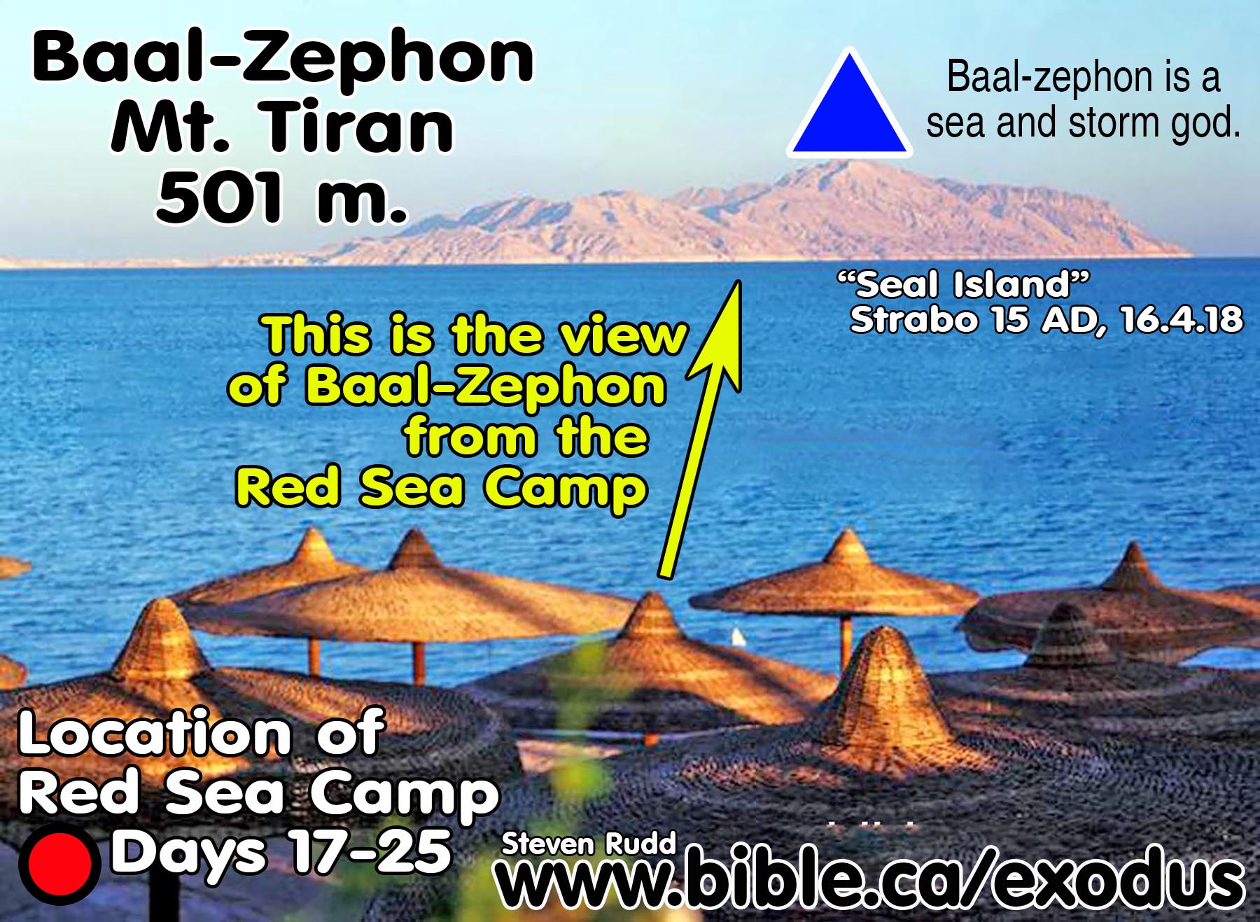
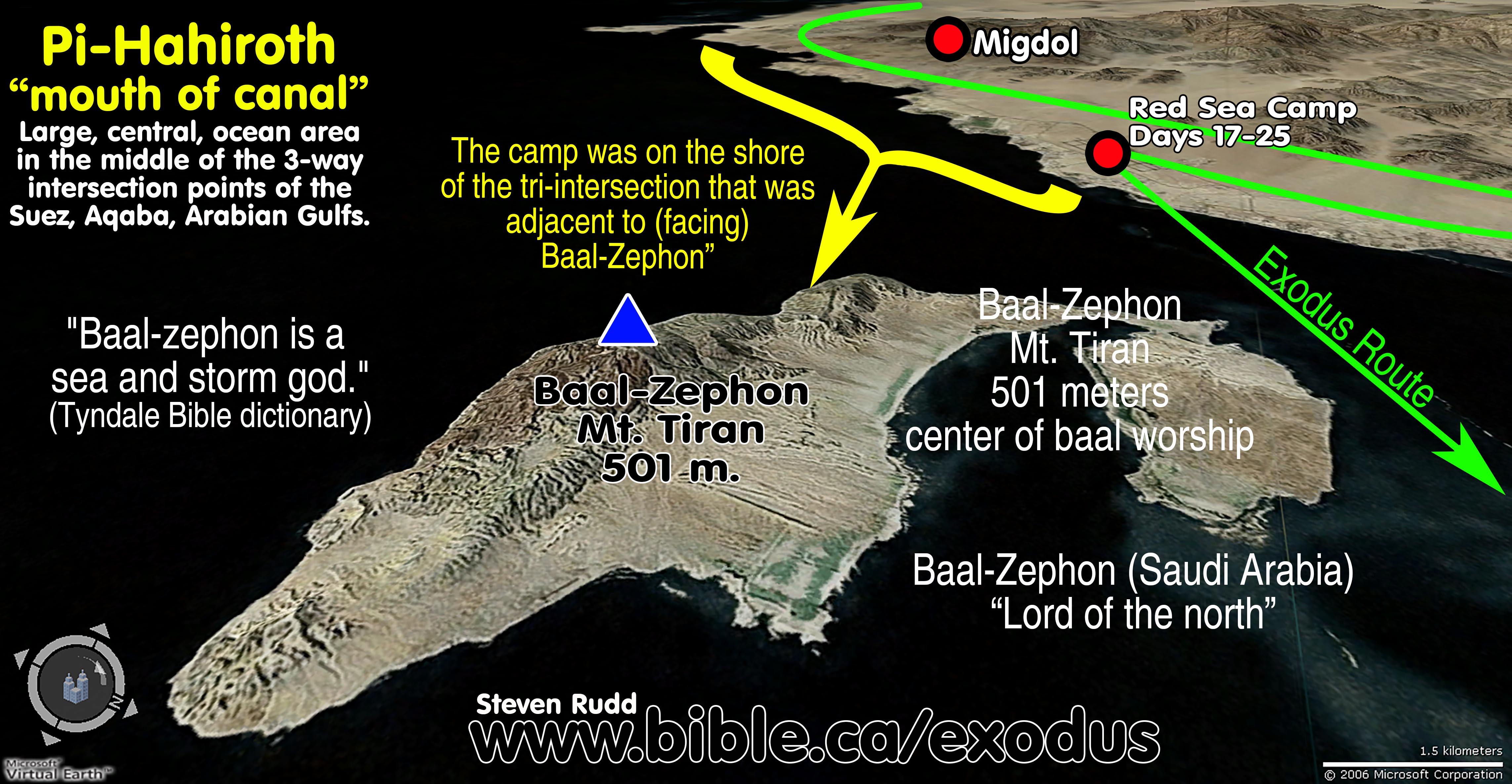
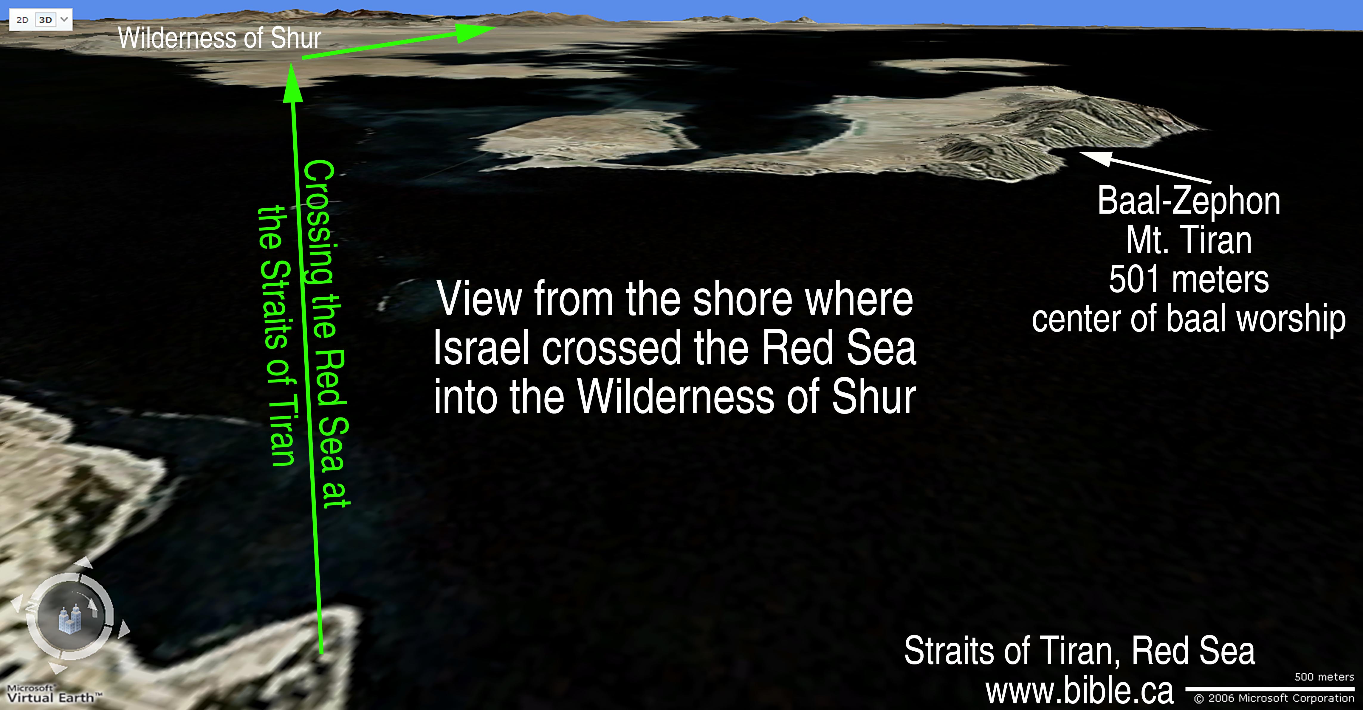
1. Baal-zephon is located at Mt. Tiran, which is 501 meters high. Mt. Tiran is located on Tiran Island, Saudi Arabia.
a. "Baal-zephon" means literally: "lord of the north". (Baal = lord + zephon = north.)
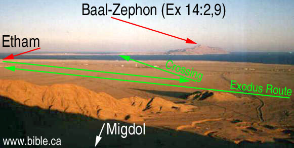
b. Baal-zephon was a clearly visible marker across the Red Sea.
c. The language of the Bible indicates it was on the opposite shore of the Red Sea: "camp in front of Baal-zephon, opposite it". (Ex 14:2)
d. There is no archeological or literary evidence for Baal-zephon being located at Tiran Island.
2. Research sources:
a. “Baal-Zephon literally means “Lord of the North,” pointing to the Ugaritic storm god Hadad, often called Baal in Ugaritic texts and the Bible. The name Zephon derives from Mount Zephon, or Jebel el-Aqra, which is 25 miles (40 km) north of Ugarit on the coastal border of present-day Syria and Turkey. The mountain Baal-Zephon is where Baal supposedly led the pantheon of Canaanite gods, and it came to signify the direction north for the Israelites (see Isa 14:13; Gen 13:14; Deut 3:27). Baal-Zephon was worshiped in Egypt at the cities of Memphis, Ras Qasrun, and Tahpanhes, likely due to Phoenician influence. Eissfeldt has shown that Baal-Zephon and the Graeco-Roman Zeus Casios are the same, and the Graeco-Roman deity came to be identified with the Canaanite one.” (LBD, Baal-Zephon)
b. “At least 3 sanctuaries of Baal-zephon in N Egypt are known: Memphis, Tahpanhes (Tell Defneh), and Mt. Casius at Ras Qasrun. Possibly one of the temples at Tell el-Dabʿa, located 2 km south of Qantir, was dedicated to Baal (Bietak 1981:253). A migdol that is probably called “of Baal-zephon” is mentioned in the Cairo papyrus 31169. Its location seems to have been near Wadi Tumilat (Davies 1979:81). There were probably additional Baal-zephon sites in N Egypt, since the Canaanite religion was popular there at various times” (ABC, Baal-zephon, Vol 1, p554)
c. "The god Baal-zephon is mentioned in Ugaritic, Egyptian, and Phoenician writings as a sea and storm god." (Tyndale Bible dictionary)
3. In 169 BC, Agatharchides describes Tiran Island:
a. “Adjacent to the coast just mentioned is a region people have named Duck Country because of the abundance of these creatures. Duck Country [Island of Tiran] itself lies near a very thickly wooded promontory [peninsula]. If one sights along a straight line drawn through it, the line would extend to the so-called Rock [Petra] and Palestine to which the Gerrhaeans, Minaeans and all the Arabs, whose settlements are nearby, bring frankincense, as is the report, together with cargoes of incense from the upper country. (Agatharchides of Cnidus, On the Erythraean Sea 169 BC, translated by Stanley M. Burstein, 1989, book 5, fragment 89a. Photius 897 AD, Cod. 250.87, 457a-457b)
b. See also: Strabo 16.4.18
A. Bible Texts:
- ""Tell the sons of Israel to turn back and camp before Pi-hahiroth, between Migdol and the sea; you shall camp in front of Baal-zephon, opposite it, by the sea." Exodus 14:2
- "Then the Egyptians chased after them with all the horses and chariots of Pharaoh, his horsemen and his army, and they overtook them camping by the sea, beside Pi-hahiroth, in front of Baal-zephon." Exodus 14:9
- "They journeyed from Etham and turned back to Pi-hahiroth, which faces Baal-zephon, and they camped before Migdol." Numbers 33:7
B. The positioning of the camp of Israel:
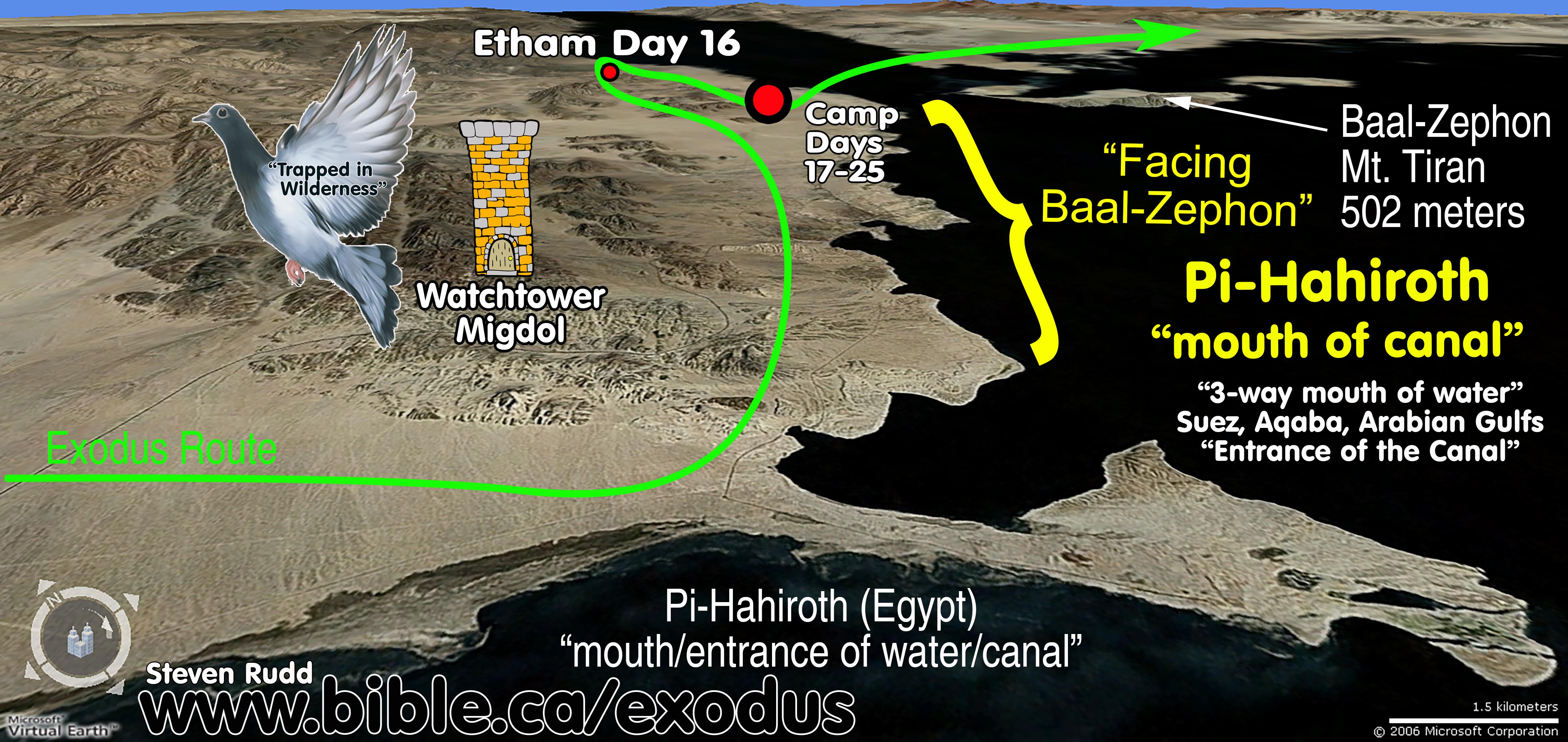
1. Scripture says that Israel came to a dead end at Etham, then God told them to turn back and retrace their steps and camp directly beside the "Migdol" in order for pharaoh to say, "Now the Lord spoke to Moses, saying, "Tell the sons of Israel to turn back and camp before Pi-hahiroth, between Migdol and the sea; you shall camp in front of Baal-zephon, opposite it, by the sea. "For Pharaoh will say of the sons of Israel, 'They are wandering aimlessly in the land; the wilderness has shut them in.' "Thus I will harden Pharaoh's heart, and he will chase after them; and I will be honored through Pharaoh and all his army, and the Egyptians will know that I am the Lord." And they did so." Exodus 14:1-4
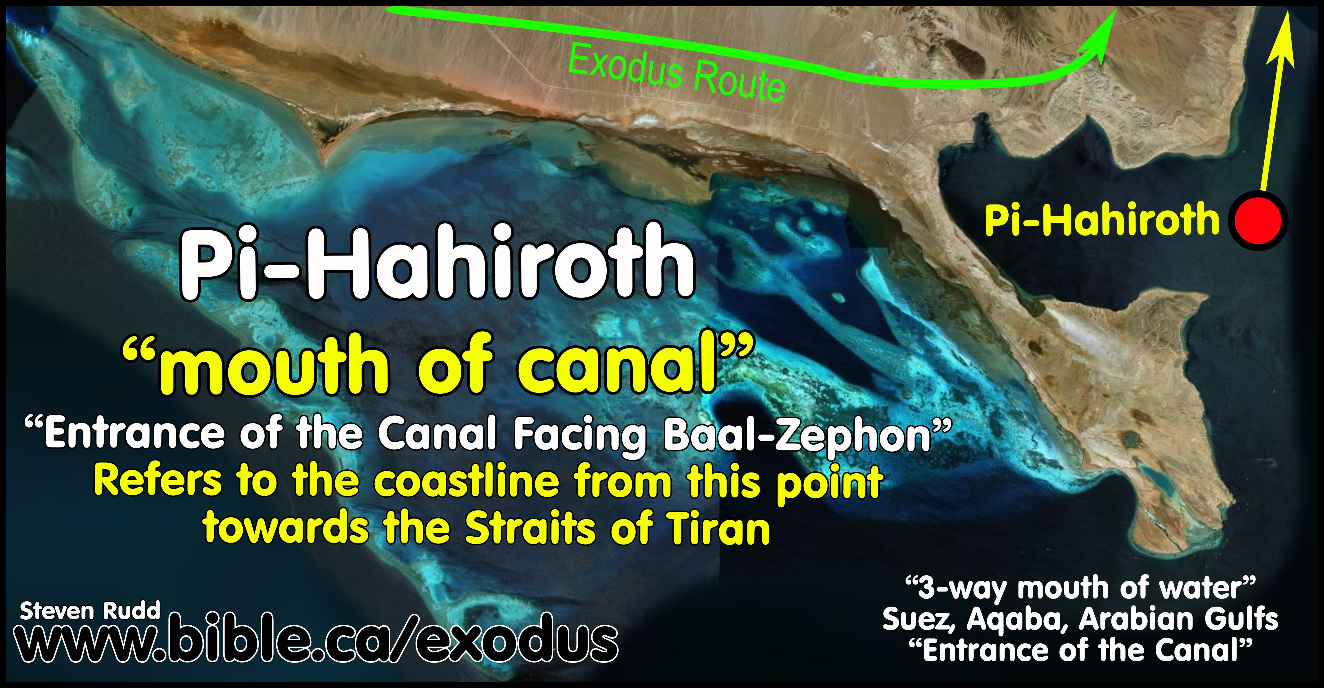
2. Pi-hahiroth means a "mouth of water" or “entrance to the canal” in Hebrew: Exodus 14:2 Numbers 33:7
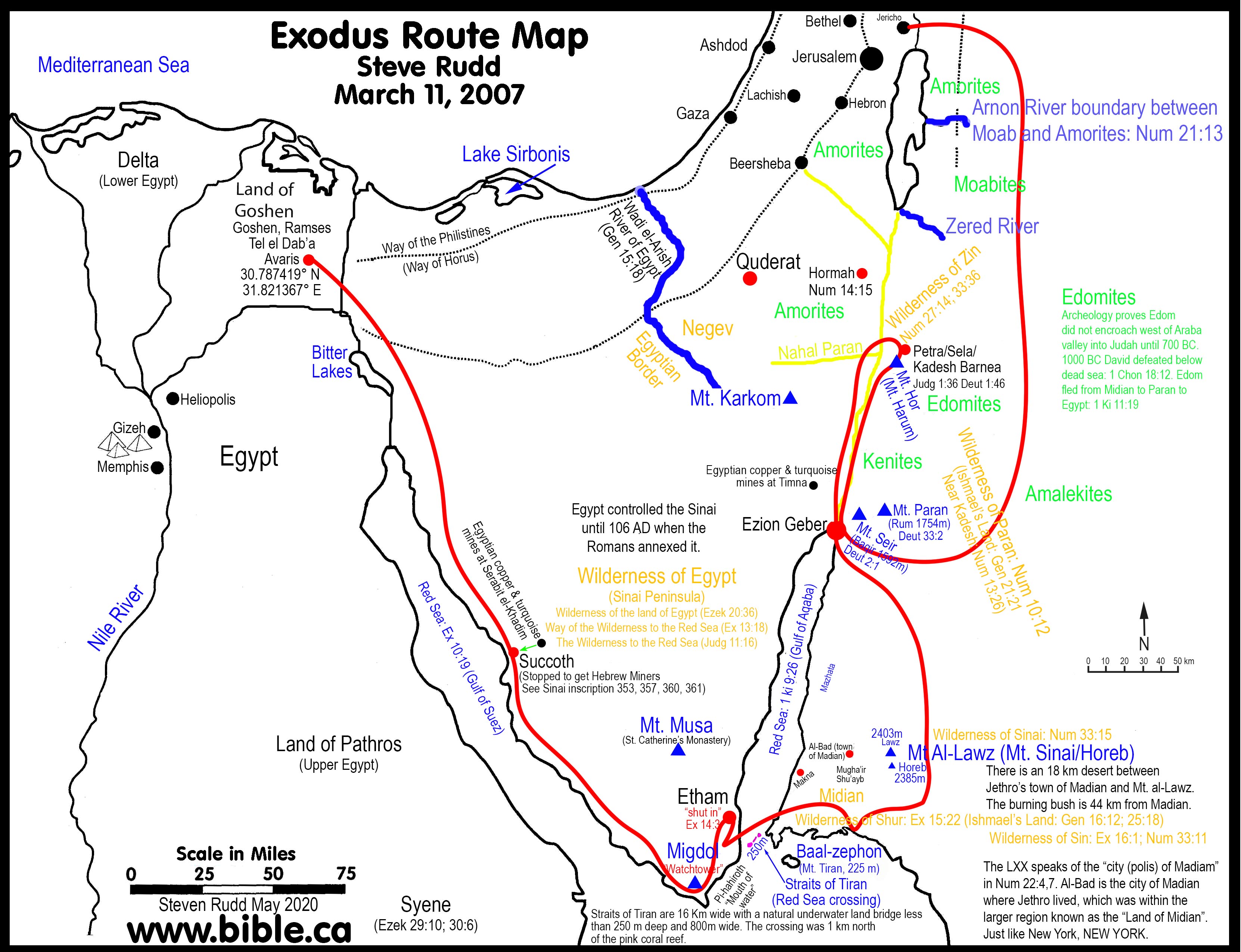
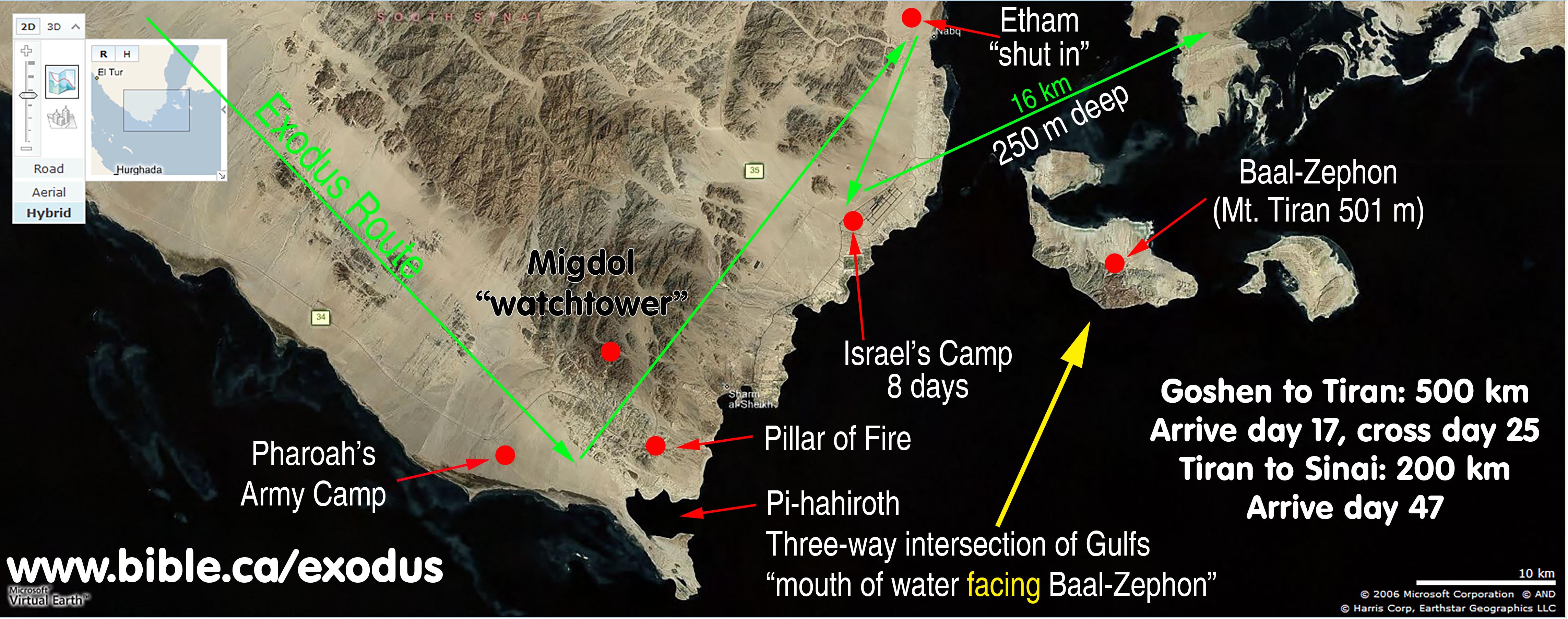
3. Pi-hahiroth, “entrance to the canal” refers to the large, central, tri-intersection of ocean between the Gulf of Suez, the Gulf of Aqaba and the Gulf of Arabia.
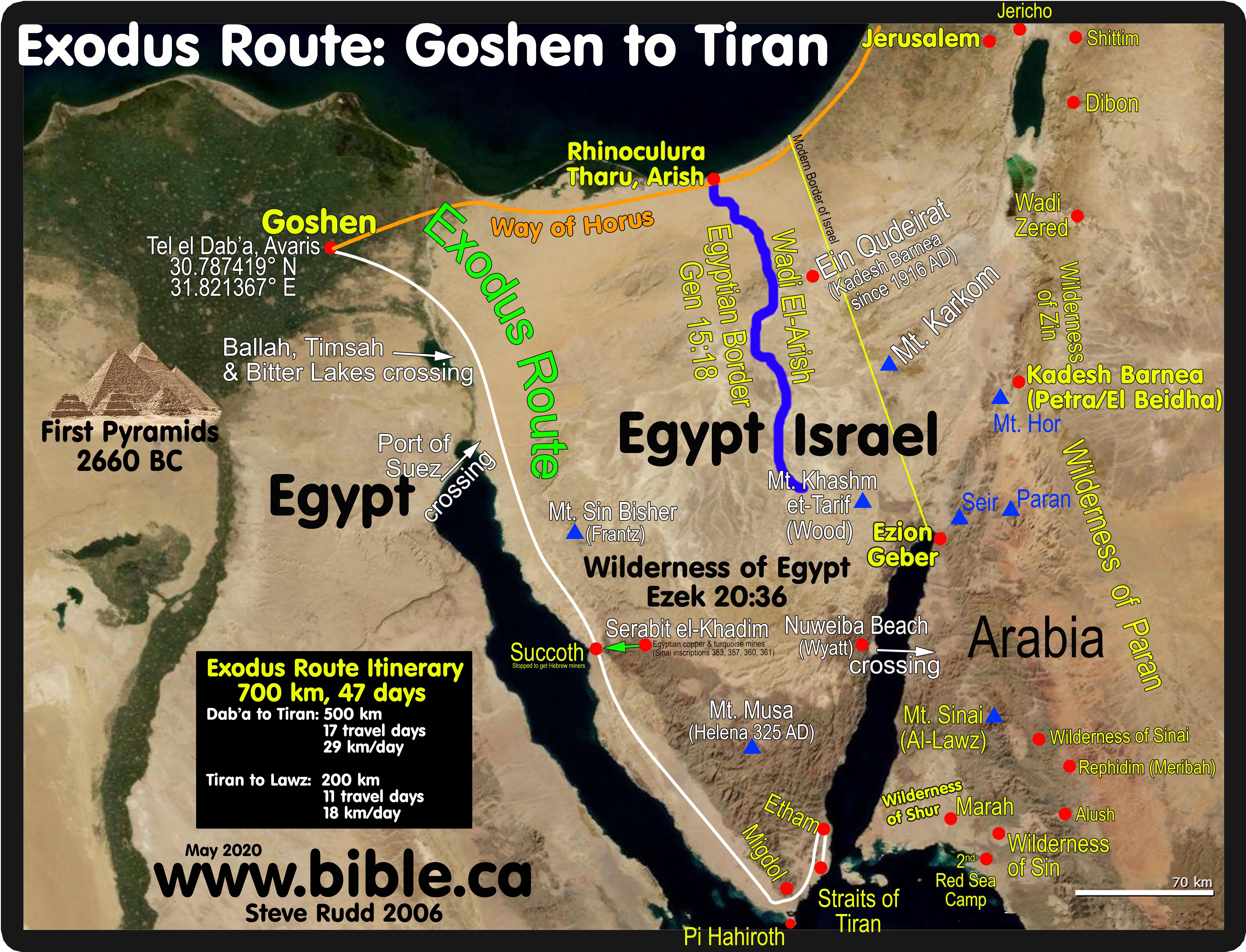
a. This could refer to an area of shoreline on either Egypt proper, the modern Sinai Peninsula or Arabia.
b. Without a second geographical marker, the "mouth of water" simply refers to the central place where all three bodies of water meet.
4. God provided a second geographic marker for the location of the Red Sea camp by saying it was located at Pi-Hahiroth “facing” or “towards” Baal-Zephon.
a. This second geographic reference “entrance to the canal FACING Baal-Zephon” identifies the shoreline from the southern tip of the modern Sinai Peninsula north towards the Gulf of Aqaba.
b. Baal-zephon is located at Mt. Tiran, which is 501 meters high. Mt. Tiran is located on Tiran Island, Saudi Arabia. The language of the Bible makes it clear that it was on the opposite shore of the Red Sea: "camp in front of Baal-zephon, opposite it". (Ex 14:2)
c. The Israel Red Sea camp was below the Egyptian military Migdol’s watchful eye, at the part of the tri-intersection of the three Gulfs which were directly opposite Baal-Zephon.
|
Geographic reference |
Israelite Camp: Exodus 14:2,9 |
Israelite Camp: Num 33:7 |
|
Pi-hahiroth "mouth of water" |
before Pi-hahiroth |
turn back to Pi-hahiroth |
|
Migdol "watchtower" |
between Migdol and the sea |
camped before between Migdol |
|
Baal-zephon (idol Baal) |
camp in front of Baal-zephon, opposite it |
Pi-hahiroth faces Baal-zephon |
C. Photos:
|
This is how Baal-Zephon looked to the Hebrews from the Red Sea camp for 8 days. |
|
|
Aerial view |
|
|
Tiran Island |
|
|
Here is a view of Baal-Zephon from the hills in front of the camp. |
|
|
Pi-Hahiroth looked like a mouth to the Hebrews, so they named it Pi-Hahiroth. |
|
|
The "mouth" faces Baal-Zephon: Num 33:7 |
|
|
Standing on the shore where they crossed to the wilderness of Shur. |
By Steve Rudd: Contact the author for comments, input or corrections.
